
ConoceRDAll 38 places

Ticket No. 0016

One-way ticket

Puerto Plata

Puerto Plata

Victorian houses, a fortress facing the harbor and a cable car up Loma Isabel de Torres, on the north coast, facing the Atlantic.

  • Leaves fromZona Colonial
  • Distance229 km
  • Driving3 h 9 min
  • Up the mountainCable car
  • ProvincePuerto Plata

StubNo. 0016

26°Now, mostly clearRead at 12:45 AM
8 minCable car ride up
1857Victorian style arrives
Puerto Plata
Culture
Puerto Plata
Puerto Plata
Zona Colonial
Zona Colonial229 km, 3 h 9 minPuerto Plata
  • AirportGregorio Luperón, 15 minutes away
  • DowntownVictorian houses and a gazebo
  • On the mountainBotanical garden and a Christ replica
  • BeachesPlaya Dorada, Costámbar and Cofresí
KM 0, Zona Colonial

229 km to the Atlantic coast

From the Zona Colonial it's 229 km by road, about 3 h 9 min of driving, to the north coast.

Puerto Plata sits between the Atlantic Ocean and Loma Isabel de Torres. Most sources date its founding to 1502, by Nicolás de Ovando.

If you fly in, Gregorio Luperón airport is about 15 minutes from downtown.

Downtown

Victorian houses since 1857

Downtown keeps its Victorian houses, a style that arrived from 1857 on. In Parque Independencia there's an octagonal gazebo from the late 19th century.

Nearby are the Catedral de San Felipe Apóstol and the Calle de las Sombrillas, the umbrella street.

Also the Museo del Ámbar, the amber museum, in a Victorian house from 1918.

In about eight minutes, the cable car takes you up the mountain.
1564Fortaleza San Felipe
UmbrellasThe downtown street
The mountain

Eight minutes by cable car up to the Christ

The cable car, opened in 1975, climbs the mountain in about eight minutes, in cabins for 17 people.

At the top there's a botanical garden and a replica of Rio de Janeiro's Christ the Redeemer.

By the sea

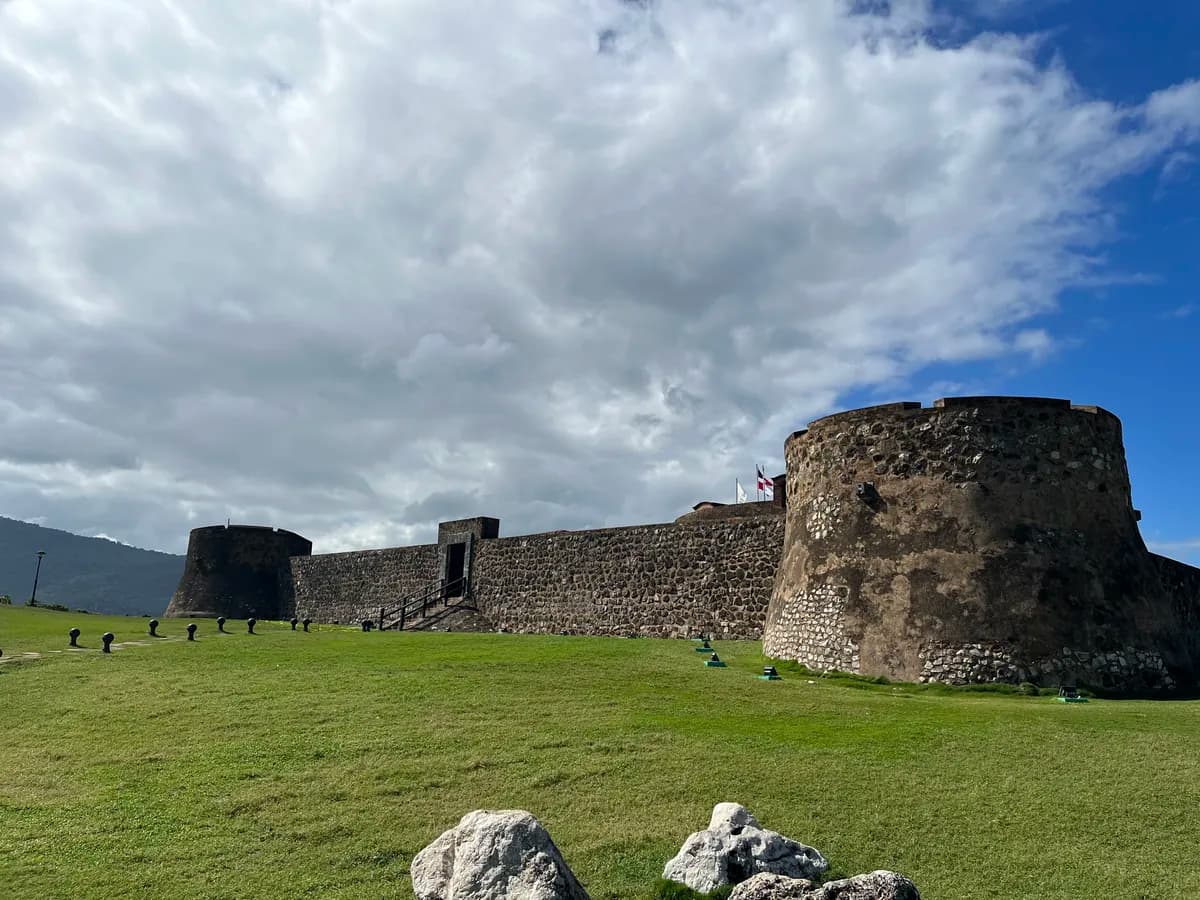
A fortress built from 1564 to 1577, now a museum

Facing the harbor is the Fortaleza San Felipe, built between 1564 and 1577 to defend the north coast from pirates and rival powers. Today it's a museum.

The Malecón runs along the coast, and the beaches in the area include Playa Dorada, Costámbar and Cofresí.

KM 229, before you go

First the mountain, then the Malecón

  • Take the cable car up early and leave the afternoon for downtown and the Malecón.

Next stops

Sources

  1. Road distance and drive time: OSRM, calculated by ConoceRD on Sep 15, 2026
  2. Wikipedia (es), San Felipe de Puerto Plata
  3. Live weather: Open-Meteo, reading from 12:45 AM
  4. Go Dominican Republic, Puerto Plata
  5. Wikipedia (en), Puerto Plata
  6. Wikipedia (en), Fortaleza San Felipe