
ConoceRDAll 38 places

Ticket No. 0006

One-way ticket

Los Haitises

Bahía de San Lorenzo

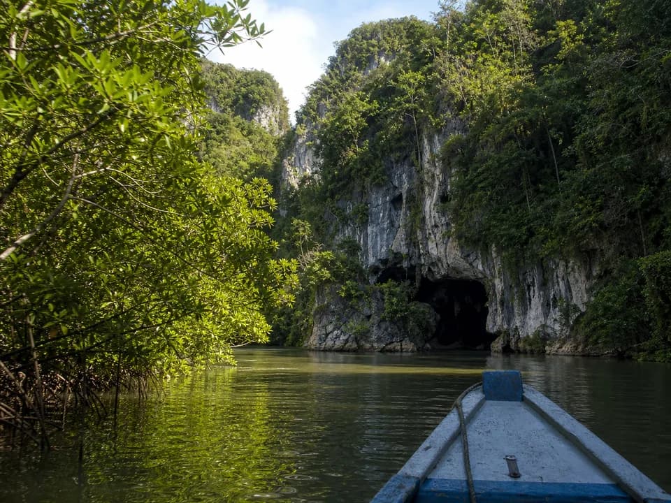
Limestone mogotes, mangroves and caves with Indigenous pictographs on the south shore of Samaná Bay. Almost everyone arrives by sea.

  • Leaves fromZona Colonial
  • Distance82 km
  • Driving1 h 45 min
  • Last stretchBoat
  • ProvinceSamaná

StubNo. 0006

24°Now, clearRead at 12:45 AM
1976National park
110Bird species
Los Haitises
Nature
Los Haitises
Bahía de San Lorenzo
Zona Colonial
Zona Colonial82 km, 1 h 45 minLos Haitises
  • You leave fromSabana de la Mar, Sánchez or Samaná
  • What you seeMangroves, caves and Cayo de los Pájaros
  • How you get inAlways with a guide
  • BringRepellent and shoes for wet ground
KM 0, Zona Colonial

82 km by road, and the rest by water

From the Zona Colonial it's 82 km by road, about 1 h 45 min of driving.

Los Haitises is a national park on the south shore of Samaná Bay, spread across Samaná, Hato Mayor and Monte Plata. It was created in 1976.

The name comes from Taíno and means "high land," even though its mogotes, limestone hills, stand between 30 and 40 meters tall.

The last stretch

You go in by sea, and always with a guide

Almost everyone arrives by sea, from Sabana de la Mar, Sánchez or Samaná.

From Samaná there's a ferry to Sabana de la Mar, which is where the park boats leave from. The visit is made with a guide.

Almost everyone arrives by sea.
30 to 40 mHeight of the mogotes
Caño HondoKayak departures
By boat

Frigatebirds and pelicans at Cayo de los Pájaros

The boat crosses the mangroves to San Lorenzo Bay and Cayo de los Pájaros, where frigatebirds and pelicans nest. The park has the largest expanse of mangrove in the Caribbean.

Of the country's 270 bird species, 110 live here.

The caves of La Línea, La Arena and San Gabriel hold Indigenous pictographs and petroglyphs.

By kayak

Two to four hours paddling through Caño Hondo

From Caño Hondo, kayak tours of two to four hours head out along the Caño Hondo River and its mangroves.

KM 82, before you go

Repellent, shoes and the ferry schedule

  • Repellent and shoes for walking on wet ground.
  • If you cross by ferry, confirm the time of the last return trip before you leave.

Next stops

Sources

  1. Road distance and drive time: OSRM, calculated by ConoceRD on Sep 15, 2026
  2. Wikipedia (en), Los Haitises National Park
  3. OM Viajes y Relatos, Parque Nacional Los Haitises
  4. Live weather: Open-Meteo, reading from 12:45 AM
  5. Wikipedia (es), Parque nacional Los Haitises
  6. Civitatis, kayak en Los Haitises
  7. haitises.com, kayak desde Caño Hondo