
ConoceRDAll 38 places

Ticket No. 0010

One-way ticket

Barahona

Barahona

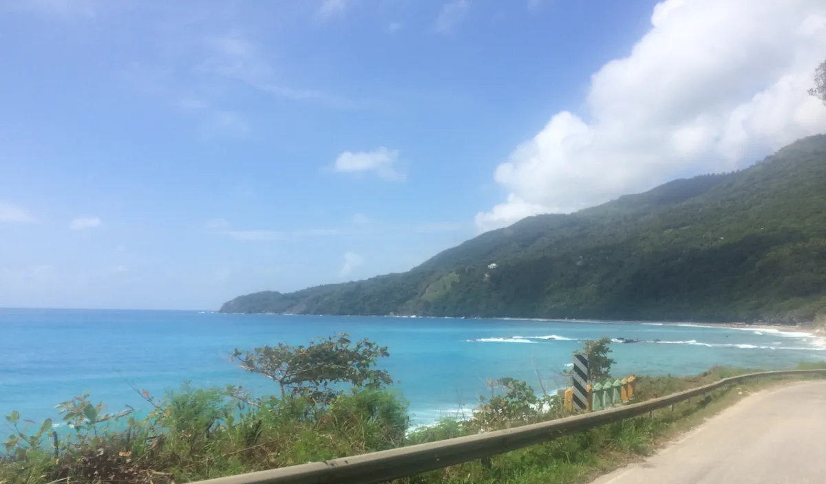
A rocky coast between the Caribbean and the Sierra de Bahoruco, with rivers that form pools by the sea, mountain coffee and larimar.

  • Leaves fromZona Colonial
  • Distance190 km
  • Driving2 h 46 min
  • BeachesRocky
  • ProvinceBarahona

StubNo. 0010

26°Now, mostly clearRead at 12:45 AM
2011Larimar, national stone
10 kmTo the larimar mine
Barahona
Beaches
Barahona
Barahona
Zona Colonial
Zona Colonial190 km, 2 h 46 minBarahona

Photo: Joel Diplan, CC BY 3.0

  • AirportIts own, the María Montez
  • Along the coastA road between the sea and the mountains
  • For a swimRiver pools at San Rafael and Los Patos
  • BringShoes for walking on rocks
KM 0, Zona Colonial

190 km to Neiba Bay

From the Zona Colonial it's 190 km by road, about 2 h 46 min of driving, to the southwest of the country.

Barahona is a city in the province of the same name, on the shore of Neiba Bay. It has its own airport, the María Montez.

The coast

Stone beaches between the Caribbean and the mountains

The coastal road toward Pedernales runs between the Caribbean Sea and the mountains.

Like most beaches in Barahona, the ones on this coast have stones instead of sand.

The beaches on this coast have stones instead of sand.
LarimarOnly in Barahona
BahorucoCoffee route
Where the river meets the sea

River pools at San Rafael and Los Patos

At San Rafael, the river forms a natural pool and a waterfall just before it reaches the sea. The waves are strong, and swimming in the sea is not recommended.

At Los Patos, the river of the same name forms a wide pool right next to the beach.

The sierra

Bahoruco coffee, and larimar, found only here

Barahona coffee is grown in the Sierra de Bahoruco, and there's a coffee route to explore it.

The province is the only place where larimar is found, a blue variety of pectolite that the country declared its national stone in 2011.

The Los Chupaderos mine is about 10 km from the city.

KM 190, before you go

Shoes for the rocks

  • Shoes for walking on rocks.
  • If you can, your own vehicle to get around between the coast and the mountains.

Next stops

Sources

  1. Road distance and drive time: OSRM, calculated by ConoceRD on Sep 15, 2026
  2. Go Dominican Republic, Playa Los Patos
  3. Live weather: Open-Meteo, reading from 12:45 AM
  4. Wikipedia (es), Larimar
  5. Wikipedia (es), Barahona
  6. got2globe, San Rafael y Los Patos
  7. Visitar República Dominicana, San Rafael
  8. Go Dominican Republic, Barahona
  9. Wikipedia (en), Santa Cruz de Barahona